
Sohbatpur district: Sohbat Khan’s village, the Desert Canal and a new district
Sohbatpur is a small, agricultural and almost wholly rural district of Balochistan's Nasirabad Division. It is among the province's youngest districts, but its name is over a century old.
Introduction and location
Sohbatpur is a small, agricultural and almost wholly rural district of Balochistan’s Nasirabad Division. It is among the province’s youngest districts, but its name is over a century old.
According to the 2023 census of the Pakistan Bureau of Statistics, Sohbatpur district covers 802 square kilometres and has a population of 240,106. This includes 121,863 men, 118,241 women and 2 transgender persons. Population density is about 299 persons per square kilometre. The urban population is only 6.13 per cent. The district’s only urban area is Sohbatpur Municipal Committee, with a population of 14,728. A household has 7.1 members on average. The population was 200,426 in 2017, an average annual increase of 3.06 per cent.
The census table shows that the district has six units: Sohbatpur Sub-Division (334 square kilometres, 64,844 people), Faridabad tehsil (137 square kilometres, 68,948), Panhwar tehsil (99 square kilometres, 47,624), Manjhipur tehsil (82 square kilometres, 23,624), Saeed Muhammad Kanrani tehsil (77 square kilometres, 18,175) and Hair Din tehsil (73 square kilometres, 16,891). In the tehsils of Faridabad and Panhwar, density is above 480 persons per square kilometre.
According to Table 2.3 of the provincial census report, the district’s internal divisions changed after 2017. In 2017, Sanhri (Hair Din) tehsil covered 331 square kilometres and had a population of 88,788. Some of its mauzas and the Manjhipur qanungo circle were separated to form three new tehsils: Saeed Muhammad Kanrani, Manjhipur and Panhwar. Hair Din was left with only 73 square kilometres. The district’s total area remained 802 square kilometres.
History
Sohbatpur is named after a tribal chief. The Sibi volume of the 1907 Baluchistan District Gazetteer, writing about the Gola tribe, says that its head, Khan Bahadur Sohbat Khan, had "recently" built the village of Sohbatpur. According to the Gazetteer, the Golas came from Sindh when canals were first opened in the territory of the State of Kalat, and took land on lease from the Khan of Kalat. Most of them worked as cultivators.
On the origin of the tribe’s name, the Gazetteer records a tribal tradition that their forefathers came with Mir Chakar as guides, called "Golo" in Sindhi. They were also known as "Mirali". According to the 1901 census, the Golas numbered 5,134 in Nasirabad tehsil.
In British times, Sohbatpur was part of Nasirabad tehsil, whose administration the Khan of Kalat had assigned in perpetuity to the British Government under the agreement of 17 February 1903. According to the Gazetteer, Sohbatpur was among the important villages of the tehsil, and one of the tehsil’s nine "circles" was also named Sohbatpur. The names of several tehsils of today’s district, such as Manjhipur and Sanhri, also appear among the circles and villages of that period. The Gazetteer also mentions Public Works Department levy posts at Sohbatpur and Manjhipur.
The district’s status is recent. According to a Daily Times report of August 2017, Lehri and Sohbatpur were made districts in 2013 under the caretaker government. The 2017 census lists Sohbatpur as a separate district. The official notification of its creation was not available when this draft was prepared.
According to reports on the July 2026 administrative restructuring, Nasirabad Division remains among the new eleven divisions, but its final composition has yet to be checked against the notification. This page follows the boundaries of the 2023 census.
People and languages
According to the mother-tongue table of the 2023 census, Balochi is the largest language in Sohbatpur: 161,801 people, about 67 per cent, give it as their mother tongue. Sindhi is the mother tongue of 42,335 (about 18 per cent), Brahui of 19,009 (about 8 per cent) and Saraiki of 15,311 (about 6 per cent). Pashto, Urdu and Punjabi speakers are very few. Sindhi speakers have a larger share in Sohbatpur Sub-Division: 21,801 of 64,844, about a third.
According to the religion table, about 99 per cent of the population is Muslim; there are 1,664 Hindus and 499 Christians.
In education, Sohbatpur is ahead of the other districts of its division. According to the census, literacy among the population above ten years of age is 41.02 per cent: 53.26 per cent among men and 28.42 per cent among women. According to the literacy brackets in the provincial report, Nasirabad, Jhal Magsi, Kachhi and Jafarabad all fall in lower brackets than Sohbatpur. Even so, the gap between male and female literacy is more than 25 per cent. There are 48,360 children aged 5 to 16 out of school, and the provincial report places Sohbatpur among the districts where 50 to 60 per cent of children do not attend school.
Economy
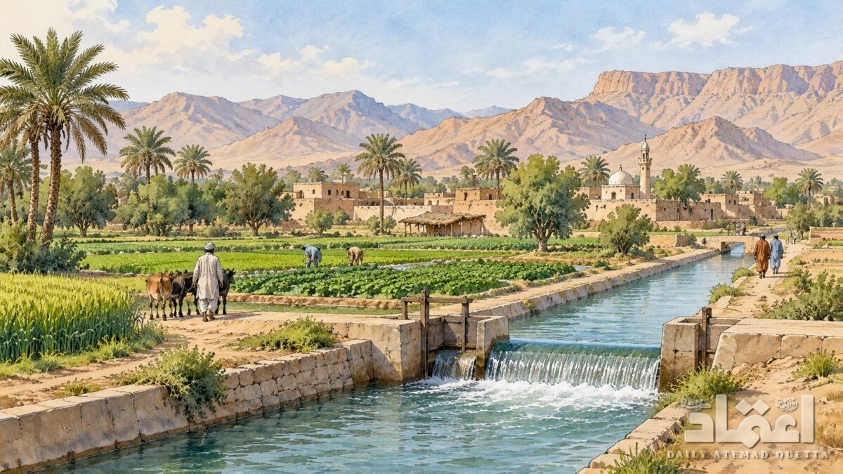
Sohbatpur’s economy has always been canal agriculture. According to the Sibi Gazetteer, in 1905 the Sohbatpur circle was among the few areas where all cultivation was canal-irrigated; water came from the Desert Canal (Shahi Wah), which takes off from the River Indus. In Manjhipur 99 per cent of cultivation, and in Sanhri 80 per cent, was canal-irrigated.
According to the Gazetteer, in Nasirabad canal produce was generally divided equally between landlord and tenant, but in the Sohbatpur circle the landlord took three-fifths of all crops except wheat, and two-fifths of wheat. The main kharif crops of that time were jowar, sesame, rice, cotton and indigo, while wheat, gram and oilseeds were grown in rabi.
According to the household facilities figures of the 2023 census, Sohbatpur is among the districts where 15 to 20 per cent of houses are pacca. Electricity is the source of lighting in 60 to 80 per cent of homes, and 30 to 40 per cent of homes have drinking water inside the premises. By contrast, homes using gas or LPG for cooking are fewer than five per cent.
Places of interest
Sohbatpur town: The district’s only urban area. According to the 1907 Gazetteer, the village of this name was "recently" built by the Gola chief Sohbat Khan.
Desert Canal system: According to the Gazetteer, the Desert Canal was based on an old canal called Maqsud Wah, which local landlords improved in 1870; in 1873 the Government took it over and widened and lengthened it. The Gazetteer says one of its purposes was to water the large lands of the State of Kalat and so promote settlement there. Its four branches, Shahi Wah, Frontier Rajbaha, Uch Rajbaha and Manjuthi Rajbaha, irrigated this entire region.
Sources
- Pakistan Bureau of Statistics, 7th Population and Housing Census 2023, Table 1: Area, Population by Sex, Sex Ratio, Population Density, Urban Population, Household Size and Annual Growth Rate, Balochistan districts, Islamabad, 2024, PDF p.9 (Sohbatpur district and its sub-division and tehsils). https://www.pbs.gov.pk/wp-content/uploads/census_tables/tables/table_1_balochistan_districts.pdf
- Pakistan Bureau of Statistics, Census 2023, Table 2: Urban Localities, Balochistan, PDF p.3 (Sohbatpur MC). https://www.pbs.gov.pk/wp-content/uploads/census_tables/tables/table_2_balochistan_districts.pdf
- Pakistan Bureau of Statistics, Census 2023, Table 9: Population by Sex, Religion and Rural/Urban, Balochistan, PDF p.40. https://www.pbs.gov.pk/wp-content/uploads/census_tables/tables/table_9_balochistan_districts.pdf
- Pakistan Bureau of Statistics, Census 2023, Table 11: Population by Mother Tongue, Sex and Rural/Urban, Balochistan, PDF pp.34-35. https://www.pbs.gov.pk/wp-content/uploads/census_tables/tables/table_11_balochistan_districts.pdf
- Pakistan Bureau of Statistics, Census 2023, Table 12: Literacy Rate and Out of School Population (5-16), Balochistan, PDF p.50. https://www.pbs.gov.pk/wp-content/uploads/census_tables/tables/table_12_balochistan_districts.pdf
- Pakistan Bureau of Statistics, Provincial Census Report 2023: Balochistan, Islamabad, 2024: p.48 (Table 2.3: Sohbatpur 2017 figures; Sanhri/Hair Din tehsil split into Saeed Muhammad Kanrani, Manjhipur and Panhwar tehsils), p.90 (literacy brackets), p.94 (out-of-school brackets), p.111 (pacca houses), p.117 (drinking water inside premises), p.121 (electricity), p.123 (gas/LPG). Printed page numbers, mapped with pdftotext. https://www.pbs.gov.pk/wp-content/uploads/2020/07/Provincial-Census-Report-2023-Balochistan-1.pdf
- A. McConaghey (comp.), Baluchistan District Gazetteer Series, Vol. III: Sibi District, Bombay: Times Press, 1907 (scan, Digital Library of India): pp.58-59 (the Gola tribe; Khan Bahadur Sohbat Khan built the village of Sohbatpur), p.111 (Desert canal: circles and share under canal irrigation, four branches, Maqsud Wah, 1870 improvement, taken over by Government in 1873, purpose of supplying Kalat territory), p.119 (crop-sharing in Sohbatpur circle), p.221 (levy posts at Manjhipur and Sohbatpur), pp.260-262 (1903 agreement; Gola population 1901; Sohbatpur among important villages and circles; crops). https://archive.org/details/in.ernet.dli.2015.279672
- Daily Times, "Balochistan needs more districts or better administration?", 17 August 2017. https://dailytimes.com.pk/120586/balochistan-needs-more-districts-or-better-administration/
- July 2026 restructuring, as recorded in content/districts/00-district-list.md: Dawn, 12 July 2026, https://www.dawn.com/news/2014773/balochistan-undergoes-major-restructuring ; ProPakistani, 12 July 2026, https://propakistani.pk/2026/07/12/balochistan-govt-notifies-new-divisions-and-districts/ (not opened in this session)
 More from Districts
More → Surab district: upper Jhalawan valley and source of the Hingol
 Usta Muhammad: from Muhammadpur's leather trade to a new district
 Washuk district: date groves, Hamun-i-Mashkel and desert
 Zhob district: from Fort Sandeman to Zhob
 Ziarat district: juniper forests and the summer capital of Balochistan
 Awaran district: the valleys of Kolwa, Mashkai and Jhao
 Barkhan district: fertile valley at the foot of Koh-e-Suleman on the Punjab border
 Chagai district: volcanic mountains, dry lakes and copper-rich land